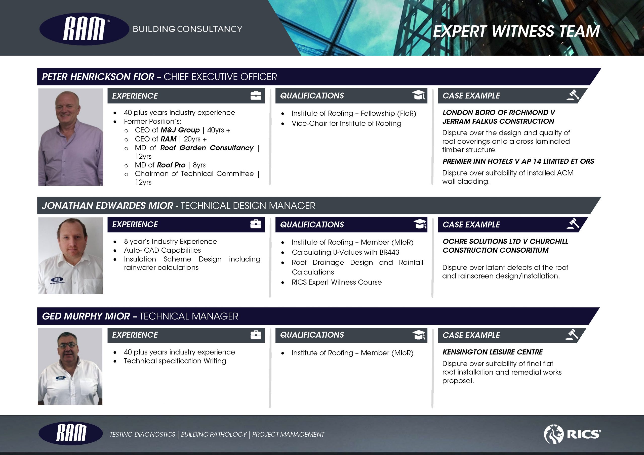

|
|
3D drone imaging is a great way to visualise the 3 dimensionalities of your building.
Building inspections of roofs, chimneys, towers, stadiums, wind turbines, church spires, etc., no longer need expensive cherry-pickers or scaffolding. What was once a difficult and expensive task to accomplish can now be achieved much more cost-effectively using our remotely piloted aerial drone systems.
Our drones can reach difficult areas with ease, and our solution is quick, safe, and effective. We can provide you with a series of high-resolution images, high-definition videos, and an online, measurable 3D model where we can pinpoint elements, measure distances, calculate areas (including walls or roof dimensions), and share the annotated model with your team and clients.
We work with property owners, architects, estate agents, chartered surveyors, local councils, insurance firms, and other organisations to create 3D drone building surveys, with commercially approved pilots capturing millimetre-accurate images.
From simply capturing images you can get an in-depth understanding of the space being inspected.
3D models
3D models are created by photogrammetry. The drone camera will capture hundreds, even thousands of overlapping photos of the ground, structure, or model. The photos will overlap each other, with an overlap of 80 to 90%. The 3D map or 3D model is then created using aerial image stitching photogrammetry software to form a virtual on-screen model which can be viewed from all angles as well as zoomed in/out.
We can also annotate the imagery with essential information and provide detailed condition reports to share the results with our clients.
3d drone imaging examples
Here is an example of how inspecting a roof can be more efficient with drone mapping: